Yesterday morning I was up at 6:00 and getting ready for a trip down south. My new caving friend Chris, from Cincinnati was coming down and he was bringing a new friend. They picked me up and then we drove down I-75 until we got to Richmond. There we went to Ryan's buffet... It was amazing... for $5 we got all the bacon, eggs, sausage, hash browns, and much much more that we could eat. By the end the thought of more food made me want to hurl. But we all felt more than ready to take on a cave.
A while later we arrived at parking and suited up. Then we descended into the realm of darkness... We made really good time and we were going to stop by the skylight dome so Chris's friend, Ken, could see it. On the way in there was a good amount of cave life.
(Frog at the bottom of the skylight dome)
We stayed there for a couple minutes, and then went back out and went down the long passage that leads to the Art Room and surrounding passages. But our goal was to give finding the Hurricane Pit Entrance another shot. So we made the climb into the pit again (called the Pagonda) and then entered the canyon. We searched high and low again. We pushed several leads but still ended up getting nowhere. I wedged myself into tight places trying to get past, and we cut and banged ourselves up. It was frustrating to feel a breeze coming from somewhere, but we could not follow it.
In one instance I climbed up three "levels" and found a small hole, about 18" wide. I forced my way in and saw it curved up and around to the left a little bit, but I couldn't see if it led anywhere. So I clawed my way in, forcing through the mud until I saw it went nowhere. So then I backed up enough and attempted to come out headfirst. I got about a little below my shoulders out of the hole when I got stuck. My legs could not come out because of the angle of the hole and a rock slab in the way. No matter how I twisted or re positioned myself I still couldn't force my way out. After that struggling I was really having to work hard to not panic. It's the first time I've ever had to keep my cool.
I backed into the tiny room again, and then squirmed my way forward, and slowly angled my legs out and I came out feet first, the same way I entered. I was glad to be out and before I made the climb (and couple squeezes) down I rested.
During our exploration we also encountered a small dome we climbed to the bottom of and discovered a bunch of rusty cable... No idea why it is there.
At that point we decided we weren't going to come back to look for the entrance until we could hopefully get some direction. But the hard part is almost nobody knows how to get to the entrance from the inside. It makes you wonder if it really exists.
We made our way out, climbed out of the Pagonda, and made our way out. We ran into a group from Dayton, OH that was going to the skylight dome. We continued on and climbed down to the stream level. On the way out we went up to the Fountain Room. But most of the stuff was dry and not impressive. So then we continued on and made our way out. It was a disappointing trip because we still didn't find the elusive hurricane pit, but it was still a great time!
Video from the trip: http://www.youtube.com/watch?v=H1U8nWosmSs
The interesting life of an Idahoan exploring the eerie underworld of the United States
Monday, September 19, 2011
Saturday, September 10, 2011
Hurricane Pit Entrance... So Close, yet so far...
This morning I awoke, and came down to Berea where I filled up on gas (which was 20 cents cheaper than in Richmond) and then picked up Lydia at the campus. Then we headed down to Pine Hill Cave. We were meeting a younger guy from the Cincinnati grotto named Chris, and he was bringing some friends.
We made pretty good time going in. Folowing the stream in and then up to the upper level where we went to the skylight dome. Some of Chris's friends hadn't seen it.
(Entrance to the Birth Canal, leading to the skylight dome)
We sat around in the dome for a while and found a huge frog in the pool. We also found a small baby snake... Somehow these animals manage to fall in and survive the 125 foot fall. It's unbelievable. After that we made our way back out and then proceeded down Shaffer Trail. This is a long "stereotypical" cave passage. At the end of it is a narrow slot canyon which we eventually climb to the top of and pop around a corner. This brings us in the vicinity of the Art Room, which we did visit later. But our top priority was the Hurricane Pit Entrance. I had studied the map and based on my experience in the cave I had a hunch where to look. We climbed down into a pit and then climbed up the other side. Sure enough we found the passage that the entrance branched off of.
(Crooked soda straw hanging from the ceiling)
Pretty soon we came to a very small, and tight crawl. After a while it opened up and it became apparant it was a maze. There were 2 or 3 levels in this narrow canyon. I went up ahead and found what is called Tom's Attic, and a high dome at the very end of the passage.
I turned around and came back. The others had been poking around exploring the passage. We realized we weren't going to find the Hurricane Pit Entrance... It would take a full day to locate it, unless we were lucky. So instead we found places to climb up on top to the third upper level. And there were some really pretty formations up there.
After exploring some more in the upper level we crawled back out, and then went to the Art Room momentarily so the rest of the group could see the pillars and other formations in there. Then we made the long journey back out. It was a great trip... Even after a long caving trip with people you don't know, by the end there is a sense of bonding and you all enjoy your time together!
For the rest of the pictures: https://picasaweb.google.com/116396676277007122980/20110910PineHillSeptember102011
We made pretty good time going in. Folowing the stream in and then up to the upper level where we went to the skylight dome. Some of Chris's friends hadn't seen it.
(Entrance to the Birth Canal, leading to the skylight dome)
We sat around in the dome for a while and found a huge frog in the pool. We also found a small baby snake... Somehow these animals manage to fall in and survive the 125 foot fall. It's unbelievable. After that we made our way back out and then proceeded down Shaffer Trail. This is a long "stereotypical" cave passage. At the end of it is a narrow slot canyon which we eventually climb to the top of and pop around a corner. This brings us in the vicinity of the Art Room, which we did visit later. But our top priority was the Hurricane Pit Entrance. I had studied the map and based on my experience in the cave I had a hunch where to look. We climbed down into a pit and then climbed up the other side. Sure enough we found the passage that the entrance branched off of.
(Crooked soda straw hanging from the ceiling)
Pretty soon we came to a very small, and tight crawl. After a while it opened up and it became apparant it was a maze. There were 2 or 3 levels in this narrow canyon. I went up ahead and found what is called Tom's Attic, and a high dome at the very end of the passage.
I turned around and came back. The others had been poking around exploring the passage. We realized we weren't going to find the Hurricane Pit Entrance... It would take a full day to locate it, unless we were lucky. So instead we found places to climb up on top to the third upper level. And there were some really pretty formations up there.
After exploring some more in the upper level we crawled back out, and then went to the Art Room momentarily so the rest of the group could see the pillars and other formations in there. Then we made the long journey back out. It was a great trip... Even after a long caving trip with people you don't know, by the end there is a sense of bonding and you all enjoy your time together!
For the rest of the pictures: https://picasaweb.google.com/116396676277007122980/20110910PineHillSeptember102011
Sunday, August 28, 2011
Sinks of the Roundstone.... Long time no see...
I must say, it was nice not being the leader of a caving trip, for a change. I didn't have the responsibility to worry about. The occasion was Jason and Tina's birthday. Drew decided to do a small caving trip. It was just to this "boring" easy cave, but it was still a fun time.
(Looking back towards the main entrance)
When we reached what some of them call the "Prayer Room" we sat in there and the rest of the group sang some songs. I just sort of sat there in the dark. Two side passage branch off this room. Jason and I went to the left to a windy canyon section, and everyone else went right. Jason and I wound our way through until we eventually got to a dry section. It began stooping, and then there was a tight crawl ahead. I slithered in first and pretty quickly I took off my helmet.
(Looking ahead to the squeeze)
I kept going, forcing my way through, enjoying the constricting passage. Jason followed behind me. Eventually I worked my way through a really tight spot and then discovered my shoulders are too big. I tried going a little farther but then realized I was stuck. So, after a couple minutes of working back and forth I began inching my way back out of the passage, enjoying the feeling of an intense wedgie and my shirt being forced up to my neck.
(Looking back at Jason)
Jason and I went back to the "Prayer Room" and then went in the right passage. A little ways in we chimneyed and wedged ourself up a V shaped crack to reach and upper level passage so I could show him As we were sliding and wedging ourself back down the slipper V Jon and Jordan found us. The rest of the group went ahead through a bypass and were on their way out (for those of you that worry, don't. 3/4 of our group , myself included, know this cave so splitting up isn't a problem. Most of us could do our own thing).
We all picked our way out and then went out the back entrance near the railroad. Then we decided to go through the tunnel and find the third major entrance to Sinks of the Roundstone. It's an entrance used for flood water. After some hiking and sliding down a steep slope we located it. It's definately an exploration for another day which will require getting wet and muddy!
(2 1/2 foot diameter log that we found washed inside)
Overall it was a good caving trip. We changed and drove back to Berea. The rest of the gang went and got together for spaghetti... I followed was sedentary and came back home to eat Top Ramen...
(Drew, no he hurt his arm before caving, not during!)
(Looking back towards the main entrance)
When we reached what some of them call the "Prayer Room" we sat in there and the rest of the group sang some songs. I just sort of sat there in the dark. Two side passage branch off this room. Jason and I went to the left to a windy canyon section, and everyone else went right. Jason and I wound our way through until we eventually got to a dry section. It began stooping, and then there was a tight crawl ahead. I slithered in first and pretty quickly I took off my helmet.
(Looking ahead to the squeeze)
I kept going, forcing my way through, enjoying the constricting passage. Jason followed behind me. Eventually I worked my way through a really tight spot and then discovered my shoulders are too big. I tried going a little farther but then realized I was stuck. So, after a couple minutes of working back and forth I began inching my way back out of the passage, enjoying the feeling of an intense wedgie and my shirt being forced up to my neck.
(Looking back at Jason)
Jason and I went back to the "Prayer Room" and then went in the right passage. A little ways in we chimneyed and wedged ourself up a V shaped crack to reach and upper level passage so I could show him As we were sliding and wedging ourself back down the slipper V Jon and Jordan found us. The rest of the group went ahead through a bypass and were on their way out (for those of you that worry, don't. 3/4 of our group , myself included, know this cave so splitting up isn't a problem. Most of us could do our own thing).
We all picked our way out and then went out the back entrance near the railroad. Then we decided to go through the tunnel and find the third major entrance to Sinks of the Roundstone. It's an entrance used for flood water. After some hiking and sliding down a steep slope we located it. It's definately an exploration for another day which will require getting wet and muddy!
(2 1/2 foot diameter log that we found washed inside)
Overall it was a good caving trip. We changed and drove back to Berea. The rest of the gang went and got together for spaghetti... I followed was sedentary and came back home to eat Top Ramen...
(Drew, no he hurt his arm before caving, not during!)
Sunday, August 14, 2011
Indiana Cave Capers
Thursday evening my cousin Erik came up from Tennessee and we got ready to go to South-Central Indiana for their annual Cave Capers convention. I was looking forward to getting underground! We left Kentucky late Friday morning and endured the boring endless cornfields of Indiana. They seemed to never end. But finally we arrived at Camp Rivervale, where the convention was taking place this year.
(Our chicken noodle slop we had for dinner)
Nothing much was going on Friday evening so we set up camp, cooked dinner, and relaxed until we finally fell asleep. It was a nice cool night and the moon was out. There was a small point near our campsite where we could see the West fork of the White River down below.
The next morning we got up and ate a poptart and then went to the registration tent. After reading through our guidebook we decided we wanted to go to Wayne Cave. Wayne cave has about 4.25 miles of known passage at this point. It is owned by the IKC (Indiana Karst Conservancy). It was a locked cave, meaning it had a gate on it. To our surprised no one else was interested in going to this cave so Erik and I signed our waivers (required for this particular cave), got the key, and headed out.
We got stuck at the first gate to actually drive onto the property because the combination they gave us was wrong. Our new wonderful Aunt Amy worked very hard to get us the phone numbers of some people in charge of Cave Capers and we were finally able to just park outside the gate near the road and hike onto the property. Then after a hike down into a sinkhole we came to the cave entrance.
(Entrance to Wayne Cave)
Wayne Cave's entrance are two consecutive pits. The total drop between both of them is 22 feet. It's fairly easy to free climb. So Erik and I both came down and then decided it would probably be best to close the gate in the chance that somebody who wasn't supposed to come along got in. However, I checked and made sure I could lift the heavy gate open. I could.
So we climbed down the two pits and soon we came to the famous part of the cave. A 1/4 mile crawlway. It takes about 1 hour of crawling to get through. Some places had enough room to be on hands and knees. Other places you took your helmet off to get through.
(Stalactite Squeeze, looking back)
On and on we crawled. Occasionally we passed some pretty formations hanging down around us in the crawlway.
Finally we came out of the crawl and were faced with a large canyon running perpendicular to the crawl passage. After taking a break and consulting our map we deduced we were at camp 1. We decided to try and reach camp II (There was also a camp III farther on. It started to sound like climbing Everest). After traversing an old stream bed for a while and seeing some more great formations....
we came to a tricky area that is a Tri-level canyon. We wound our way through this trying to find our way to Camp II. We even climbed down to the lowest level of the canyon. It was only on the way back that when we finally realized how to get out we discovered how hard that climb was. It was the scariest climb I've ever faced in a cave and was almost certain I was going to fall. But Erik and I both made it up safely. It also didn't help we were pretty fatigued at this point. Especially since we'd only ate a pop tart for breakfast. Not exactly carb rich food you need for caving.
By this point we were stumbling out... We were ready to be done. But we still had that 1/4 mile long crawl ahead of us. It was agony, and it seemed to take forever. But we finally did it. We quickly devoured all the granola bars we had packed along with us. Rested, and then did the first climb up. We could now see daylight! So up the last pit I climbed and wedged myself into position to push up the gate only to discover......
I could hardly budge the gate! I was so tired and fatigued that I couldn't push open the heavy iron gate. So Erik squirmed his way up beside me and on the count of three we used our helmeted heads and put all our effort into swinging the gate upward and escaping the cave. And at that moment Erik slipped sliding downward a couple feet. His helmet snagged and his mag-light mounted on the side snapped off falling to the bottom of the pit. He left it there however, believing it not worth the climb back down and up to retrieve it.
So we locked the cave back up and rested for about 10 minutes before hiking back to the car to change.
It was definitely a great experience and fun caving in my third state!
(Our chicken noodle slop we had for dinner)
Nothing much was going on Friday evening so we set up camp, cooked dinner, and relaxed until we finally fell asleep. It was a nice cool night and the moon was out. There was a small point near our campsite where we could see the West fork of the White River down below.
The next morning we got up and ate a poptart and then went to the registration tent. After reading through our guidebook we decided we wanted to go to Wayne Cave. Wayne cave has about 4.25 miles of known passage at this point. It is owned by the IKC (Indiana Karst Conservancy). It was a locked cave, meaning it had a gate on it. To our surprised no one else was interested in going to this cave so Erik and I signed our waivers (required for this particular cave), got the key, and headed out.
We got stuck at the first gate to actually drive onto the property because the combination they gave us was wrong. Our new wonderful Aunt Amy worked very hard to get us the phone numbers of some people in charge of Cave Capers and we were finally able to just park outside the gate near the road and hike onto the property. Then after a hike down into a sinkhole we came to the cave entrance.
(Entrance to Wayne Cave)
Wayne Cave's entrance are two consecutive pits. The total drop between both of them is 22 feet. It's fairly easy to free climb. So Erik and I both came down and then decided it would probably be best to close the gate in the chance that somebody who wasn't supposed to come along got in. However, I checked and made sure I could lift the heavy gate open. I could.
So we climbed down the two pits and soon we came to the famous part of the cave. A 1/4 mile crawlway. It takes about 1 hour of crawling to get through. Some places had enough room to be on hands and knees. Other places you took your helmet off to get through.
(Stalactite Squeeze, looking back)
On and on we crawled. Occasionally we passed some pretty formations hanging down around us in the crawlway.
Finally we came out of the crawl and were faced with a large canyon running perpendicular to the crawl passage. After taking a break and consulting our map we deduced we were at camp 1. We decided to try and reach camp II (There was also a camp III farther on. It started to sound like climbing Everest). After traversing an old stream bed for a while and seeing some more great formations....
we came to a tricky area that is a Tri-level canyon. We wound our way through this trying to find our way to Camp II. We even climbed down to the lowest level of the canyon. It was only on the way back that when we finally realized how to get out we discovered how hard that climb was. It was the scariest climb I've ever faced in a cave and was almost certain I was going to fall. But Erik and I both made it up safely. It also didn't help we were pretty fatigued at this point. Especially since we'd only ate a pop tart for breakfast. Not exactly carb rich food you need for caving.
By this point we were stumbling out... We were ready to be done. But we still had that 1/4 mile long crawl ahead of us. It was agony, and it seemed to take forever. But we finally did it. We quickly devoured all the granola bars we had packed along with us. Rested, and then did the first climb up. We could now see daylight! So up the last pit I climbed and wedged myself into position to push up the gate only to discover......
I could hardly budge the gate! I was so tired and fatigued that I couldn't push open the heavy iron gate. So Erik squirmed his way up beside me and on the count of three we used our helmeted heads and put all our effort into swinging the gate upward and escaping the cave. And at that moment Erik slipped sliding downward a couple feet. His helmet snagged and his mag-light mounted on the side snapped off falling to the bottom of the pit. He left it there however, believing it not worth the climb back down and up to retrieve it.
So we locked the cave back up and rested for about 10 minutes before hiking back to the car to change.
It was definitely a great experience and fun caving in my third state!
Wednesday, August 3, 2011
Arthur Singleton's Cave
After what seemed like an eternity of waiting to go caving again this summer, it finally happened! A group of us from the Creation Museum, and a couple others came along: Kyle and Amanda, Matt and Amy, myself, Jimmy Rice, Katelyn Ketron, and then David Intal all finally got together as we traveled south. Finally arriving at the parking for the cave I could hardly wait to get down and dirty in the cave. So our group ate lunch, and then we headed in!
(Entrance to Arthur Singleton's Cave)
When we entered we were in a small room with some formations almost immediately. To our right stretched the main section of the cave. It was a crawling/stooping over rim stone pools, flowstone, and stalactites and stalagmites.
Kyle, Amanda, and Amy I guess were surprised by this being some of the easiest caving you can do. But they did a really good job sticking with the crawling and continuing on, even though it wasn't their favorite thing to do. I was impressed :)
After that section of crawling was over we arrived in a long passageway we could walk along. Formations decorated the passage everywhere!
(Jimmy, David, and Katelyn)
We followed this passage for a ways, missing the side passage which leads to the huge Empire Room. Instead, after some ducking and weaving, we arrived at a cross passage where a small stream system flows. While the group rested I checked out the cross section and decided this was the main water route when flooding occurs. And correctly lined this up with the passage that leads to a siphon on the map. There was a lot of organic debris that confirmed this.
So I rejoined the group and then most of us were in the group picture we took.
(Josh, David, Jimmy, Amanda, Amy, Katelyn)
Then I decided that we would go back out to the main entrance. I figured Amanda and Amy had pushed themselves enough. So we all made our way back out. Kyle joined them, and Katelyn couldn't stay with us guys to go one an adventure (she looked like a sad, dejected puppy because of that).
(On the way out...)
Then us guys went up the left side to find the domes that were on the map. We ended up going up what is called "One legged passage. Crawling and crouching through gravel until we reached what is called Nadine's Bathtub".
(On the way we ran into a fellow cave dweller)
(Matt, in "One Legged Passage")
Jimmy was out in front and he plunged into Nadine's Bathtub first. When he reached the other side and slithered out of the water we heard him exclaiming how beautiful it was up ahead and we had to follow! So one by one we all took our turn going through the muddy bathtub. When we came out we were faced with a couple domes. Water trickled from the ceilings, and there was nice flowstone coming down the sides! It was incredible!
David, Jimmy, and I climbed up some flowstone and got a nice vantage point from inside one of the domes. After looking around, however, it was time to go. So we all huddled near the entrance to Nadine's Bathtub, had a powwow, and then I went first.
(Entrance to Nadine's Bathtub)
(David, coming through the bathtub)
We took another couple minutes once all of us were through the bathtub, and then we made our way out of the cave and got changed. Then it was time to leave and head back home :(
(The fearless men: Matt, Josh, Jimmy, and David)
For all my photos from the trip: https://picasaweb.google.com/jholcomb8/20110802ArthurSingletonSCaveAugust22011
(Entrance to Arthur Singleton's Cave)
When we entered we were in a small room with some formations almost immediately. To our right stretched the main section of the cave. It was a crawling/stooping over rim stone pools, flowstone, and stalactites and stalagmites.
Kyle, Amanda, and Amy I guess were surprised by this being some of the easiest caving you can do. But they did a really good job sticking with the crawling and continuing on, even though it wasn't their favorite thing to do. I was impressed :)
After that section of crawling was over we arrived in a long passageway we could walk along. Formations decorated the passage everywhere!
(Jimmy, David, and Katelyn)
We followed this passage for a ways, missing the side passage which leads to the huge Empire Room. Instead, after some ducking and weaving, we arrived at a cross passage where a small stream system flows. While the group rested I checked out the cross section and decided this was the main water route when flooding occurs. And correctly lined this up with the passage that leads to a siphon on the map. There was a lot of organic debris that confirmed this.
So I rejoined the group and then most of us were in the group picture we took.
(Josh, David, Jimmy, Amanda, Amy, Katelyn)
Then I decided that we would go back out to the main entrance. I figured Amanda and Amy had pushed themselves enough. So we all made our way back out. Kyle joined them, and Katelyn couldn't stay with us guys to go one an adventure (she looked like a sad, dejected puppy because of that).
(On the way out...)
Then us guys went up the left side to find the domes that were on the map. We ended up going up what is called "One legged passage. Crawling and crouching through gravel until we reached what is called Nadine's Bathtub".
(On the way we ran into a fellow cave dweller)
(Matt, in "One Legged Passage")
Jimmy was out in front and he plunged into Nadine's Bathtub first. When he reached the other side and slithered out of the water we heard him exclaiming how beautiful it was up ahead and we had to follow! So one by one we all took our turn going through the muddy bathtub. When we came out we were faced with a couple domes. Water trickled from the ceilings, and there was nice flowstone coming down the sides! It was incredible!
(Matt, looking up in one of the domes)
David, Jimmy, and I climbed up some flowstone and got a nice vantage point from inside one of the domes. After looking around, however, it was time to go. So we all huddled near the entrance to Nadine's Bathtub, had a powwow, and then I went first.
(Entrance to Nadine's Bathtub)
(David, coming through the bathtub)
We took another couple minutes once all of us were through the bathtub, and then we made our way out of the cave and got changed. Then it was time to leave and head back home :(
(The fearless men: Matt, Josh, Jimmy, and David)
For all my photos from the trip: https://picasaweb.google.com/jholcomb8/20110802ArthurSingletonSCaveAugust22011
Friday, July 8, 2011
Pine Hill Lake
I finally got a much needed break from stuff that has been going on this summer. I was able to drive down to Berea and stay at my friend Daniel's house and then Thursday evening a group of us got together to go caving. The original plan was to go to Arthur Singleton's Cave (which I now knew where it was) but I decided I didn't want to make the drive. So I decided we'd go to Pine Hill Cave to do some exploring.
The spot I wanted to explore was to the right of the main entrance. There are a series of domes and what is labeled as "Pine Hill Lake". This "lake" is basically a large area of pretty slow water as it gets lower and lower into a sump before it's pretty much impossible to go any further without scuba gear. This is where it will eventually go into Blue Hole Cave.
It took us a little while to get onto the right path, while trying to follow the map. But we eventually did and came across the first couple domes.
(Some of the formations in the domes)
We ended up going the hard way, doing some climbing through break down and some domes until we eventually rejoined the main stream. After a little bit of hands and knees crawling we could stand up some and then it became obvious we were entering the edge of "Pine Hill Lake".
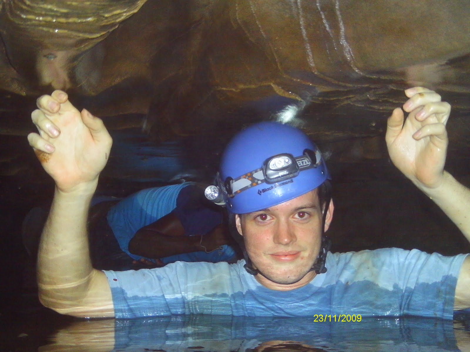
Pretty soon it became stooping, and the water began to get deeper....
And the ceiling got lower... Until we were up to our shoulders/necks in the cold murky water and our heads scraped the ceiling.
After a while we decided to not go any further into the sump. I was also trying to keep my camera dry so I held my hands above the water. But we waded our way back out, and went an easier way back near the main entrance. We had a small group meeting and then decided to go to the waterfalls. Something fun, and easy. So we traversed all the way up, and then had fun jumping off Thunder Falls into the pool below.
(Most of our group below the falls, waiting for me to jump)
We all made it out safely (obviously). It was a great fun trip. I loved wading through the sump. If the region got a lot of rain, though, it would be a very dangerous place to be, though. But it was a great break and a fun time to spend with my friends!
The spot I wanted to explore was to the right of the main entrance. There are a series of domes and what is labeled as "Pine Hill Lake". This "lake" is basically a large area of pretty slow water as it gets lower and lower into a sump before it's pretty much impossible to go any further without scuba gear. This is where it will eventually go into Blue Hole Cave.
It took us a little while to get onto the right path, while trying to follow the map. But we eventually did and came across the first couple domes.
(Some of the formations in the domes)
We ended up going the hard way, doing some climbing through break down and some domes until we eventually rejoined the main stream. After a little bit of hands and knees crawling we could stand up some and then it became obvious we were entering the edge of "Pine Hill Lake".
Pretty soon it became stooping, and the water began to get deeper....
And the ceiling got lower... Until we were up to our shoulders/necks in the cold murky water and our heads scraped the ceiling.
After a while we decided to not go any further into the sump. I was also trying to keep my camera dry so I held my hands above the water. But we waded our way back out, and went an easier way back near the main entrance. We had a small group meeting and then decided to go to the waterfalls. Something fun, and easy. So we traversed all the way up, and then had fun jumping off Thunder Falls into the pool below.
(Most of our group below the falls, waiting for me to jump)
We all made it out safely (obviously). It was a great fun trip. I loved wading through the sump. If the region got a lot of rain, though, it would be a very dangerous place to be, though. But it was a great break and a fun time to spend with my friends!
Sunday, June 5, 2011
Surveying & Digging
This weekend I wasn't scheduled to work, so I took advantage of the time off. I found out that some people from the Cincinnati Grotto were going down to the Great Saltpeter Preserve to do some cave surveying. And I jumped on board. I was picked up very early Saturday morning by Howard and we drove down to Mt. Vernon.
When we arrived we spent some time talking with other people that had come down, but then got down to business. A group of us went down and parked at Mullins Spring Cave. I was going to learn how to survey with a lady named Lacie, and Howard's wife Pam. We were going to survey a route that I never knew existed. We started at the "dry entrance" and on the left hand side there is a small passage (that ends up being mostly crawling) that you can follow. It allows you to bypass that first big pool.
So, the basics of surveying. You have stations that you set up. A good station has a good forward and backwards distance. This allows you to see for a certain range and thus set up the next consecutive station. You use a compass and an inclinometer. You align the compass with one station, and then line it up with the other, and record your reading. The same thing goes with your inclinometer. Then, you backshoot. Which means you do it from the opposite direction. Your compass and inclinometer readings should be opposites if you did it correctly. Then you also measure the distance between stations with a simple measuring tape. And, at each station you use a laser range finder to get the distances to the top, left, right, and bottom of the passages. This allows you to create cross section sketches. When you have all this done you are able to plot your data using a scale and you create your map.
I caught on pretty quick with taking measurements and by the end of our surveying in Mullins Spring Cave I was getting pretty good with measuring. And we even did some difficult steep shots. However, surveying is very cold. I didn't prepare for that. You move very slowly. And towards the end of our surveying we were scrunched up on a cold wet flowstone with a strong breeze blowing on us. It chilled us to the bone. So we exited the cave and got warmed up.
We went back to GSP and when Howard finished up a work project he and I took off. We were going to go survey Two Layer Cave. Howard had never been in it. It was just a cave that was discovered and needed to be mapped. It is near Mullins Spring Cave; just right up on the same hillside.
(Entrance to Two Layer Cave)
We set up our first survey station and because working our way down. The first shot was difficult because of the steep angle. But we worked it so Howard did the front shoots, and I did the back shoots. I was hitting the numbers really good.
After our fourth station we reached a lot of break down. There was a very strong breeze flowing through. Howard sent me up to investigate while he finished sketching. It was about this time that a few others joined us. They had been surveying Violation Cave which connects to Mullins Spring Cave. I discovered a small room that dead ended. But the breeze was blowing really strongly through a small area.
(The hole I crawled into; with the survey tape stretching into the distance)
(The backside of the room that prevented me from going any further)
The last shot was very difficult to do because of the angle. But, I got the numbers and then proceeded out of the tiny crawl. On the other side, one of the guys that had joined us, Shane, was digging.
(Shane, beginning to dig)
He had found another location where the breeze was really strong. As he dug farther he could see it opened up and the breeze just continued. It was really exciting to see somebody discovering new cave passage. He pushed on a ways and could see yawning darkness ahead. The chances are very high that Two Layer Cave connects with Mullins Spring Cave. With that large volume of air rushing through it's almost a guarantee. However, we finally called it quits and headed back to GSP to have dinner and camp. I'm excited to hear what happens as today (Sunday) Shane and his wife were going to go back and continue digging.
But in all, I had a really enjoyable (yet cold) weekend. Its really fun learning to survey. And even more neat to now have my name on the sheets for helping with Mullins Spring Cave, and helping to survey Two Layer Cave. I'm definitely going to get in on it more in the future.
When we arrived we spent some time talking with other people that had come down, but then got down to business. A group of us went down and parked at Mullins Spring Cave. I was going to learn how to survey with a lady named Lacie, and Howard's wife Pam. We were going to survey a route that I never knew existed. We started at the "dry entrance" and on the left hand side there is a small passage (that ends up being mostly crawling) that you can follow. It allows you to bypass that first big pool.
So, the basics of surveying. You have stations that you set up. A good station has a good forward and backwards distance. This allows you to see for a certain range and thus set up the next consecutive station. You use a compass and an inclinometer. You align the compass with one station, and then line it up with the other, and record your reading. The same thing goes with your inclinometer. Then, you backshoot. Which means you do it from the opposite direction. Your compass and inclinometer readings should be opposites if you did it correctly. Then you also measure the distance between stations with a simple measuring tape. And, at each station you use a laser range finder to get the distances to the top, left, right, and bottom of the passages. This allows you to create cross section sketches. When you have all this done you are able to plot your data using a scale and you create your map.
I caught on pretty quick with taking measurements and by the end of our surveying in Mullins Spring Cave I was getting pretty good with measuring. And we even did some difficult steep shots. However, surveying is very cold. I didn't prepare for that. You move very slowly. And towards the end of our surveying we were scrunched up on a cold wet flowstone with a strong breeze blowing on us. It chilled us to the bone. So we exited the cave and got warmed up.
We went back to GSP and when Howard finished up a work project he and I took off. We were going to go survey Two Layer Cave. Howard had never been in it. It was just a cave that was discovered and needed to be mapped. It is near Mullins Spring Cave; just right up on the same hillside.
(Entrance to Two Layer Cave)
We set up our first survey station and because working our way down. The first shot was difficult because of the steep angle. But we worked it so Howard did the front shoots, and I did the back shoots. I was hitting the numbers really good.
After our fourth station we reached a lot of break down. There was a very strong breeze flowing through. Howard sent me up to investigate while he finished sketching. It was about this time that a few others joined us. They had been surveying Violation Cave which connects to Mullins Spring Cave. I discovered a small room that dead ended. But the breeze was blowing really strongly through a small area.
(The hole I crawled into; with the survey tape stretching into the distance)
(The backside of the room that prevented me from going any further)
The last shot was very difficult to do because of the angle. But, I got the numbers and then proceeded out of the tiny crawl. On the other side, one of the guys that had joined us, Shane, was digging.
(Shane, beginning to dig)
He had found another location where the breeze was really strong. As he dug farther he could see it opened up and the breeze just continued. It was really exciting to see somebody discovering new cave passage. He pushed on a ways and could see yawning darkness ahead. The chances are very high that Two Layer Cave connects with Mullins Spring Cave. With that large volume of air rushing through it's almost a guarantee. However, we finally called it quits and headed back to GSP to have dinner and camp. I'm excited to hear what happens as today (Sunday) Shane and his wife were going to go back and continue digging.
But in all, I had a really enjoyable (yet cold) weekend. Its really fun learning to survey. And even more neat to now have my name on the sheets for helping with Mullins Spring Cave, and helping to survey Two Layer Cave. I'm definitely going to get in on it more in the future.
Subscribe to:
Posts (Atom)